Animal Trails and Pathways: How to Read Wildlife Movement Through the Landscape
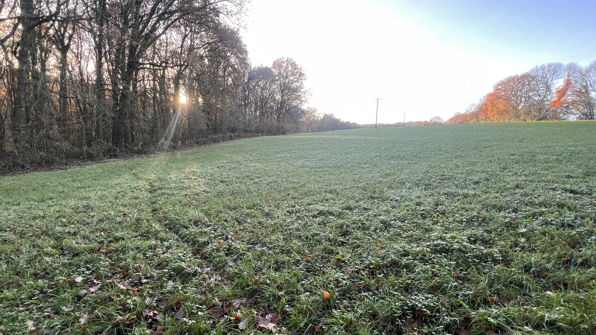
There is a faint line running through the grass in front of us. It isn’t much wider than a boot, and if it wasn’t for the frost on the grass we could easily miss it. When we look closer the stems aren’t completely flattened, but something has been regularly traveling this route and several blades of grass lean in the same direction. A few metres further on, the line disappears beneath a wire fence and into woodland.
So what made it?
It would be tempting to call it a fox path, perhaps a badger trail, and move on. But at this point we haven’t earned either conclusion.
What we do have is something potentially more useful: evidence that wildlife may be moving repeatedly through this particular piece of landscape.
That is where animal trails become interesting.
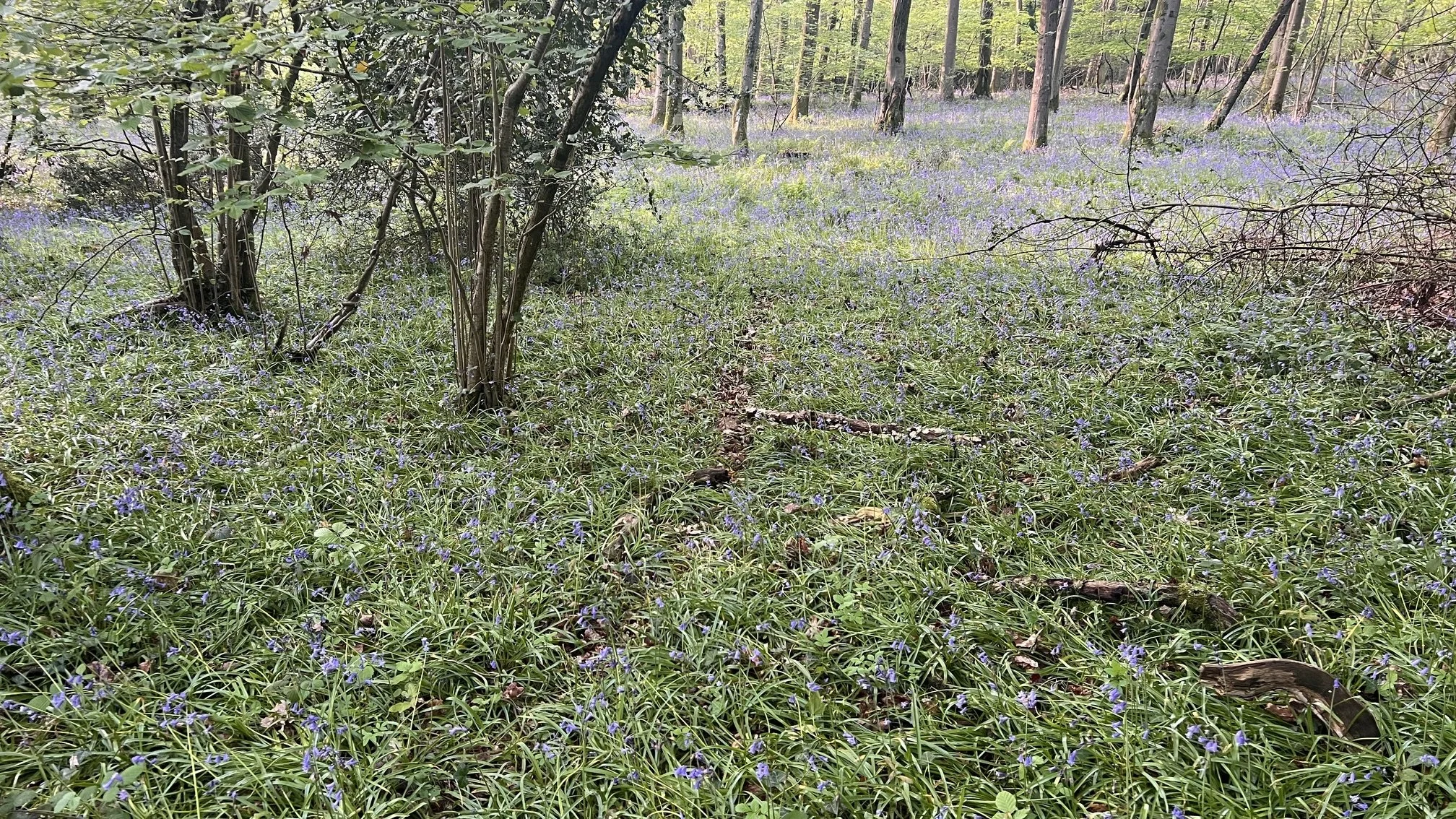
A faint route through woodland vegetation is easy to miss from standing height. Look for continuity, aligned stems and small patches of exposed
ground before deciding what created it.
A footprint records the moment an animal put its foot on the ground. A dropping shows that an animal paused or passed through a place. Feeding remains tell us that something stopped long enough to eat. An animal trail can begin to connect those isolated clues and show us how wildlife moves between places.
Once you start noticing wildlife trails and pathways, a woodland, hedgerow or field edge begins to look less like a collection of separate habitats and more like a network. There are routes through it, points where movement becomes concentrated, places where trails meet and crossings that animals return to repeatedly.
The trick is learning how to read those routes without seeing more in them than the evidence really supports.
What Is an Animal Trail?
Trackers use words such as track, trail, run, runway, path and corridor in slightly different ways, so I wouldn’t get too hung up on rigid definitions. There are, however, some useful distinctions.
A track is usually the impression left by an individual foot.
A trail is the route an animal has taken through the landscape. Sometimes that route survives as a sequence of footprints, but often there are no readable prints at all. We recognise the trail from flattened vegetation, bare soil, repeated crossings or other physical clues.
A run is generally smaller and more confined, particularly the narrow channels created by small mammals through grass or low vegetation.
A wildlife corridor operates on a larger scale. A hedgerow, riverbank, woodland edge, ditch or strip of scrub might channel wildlife through the wider landscape without there being a single obvious worn path along its length.
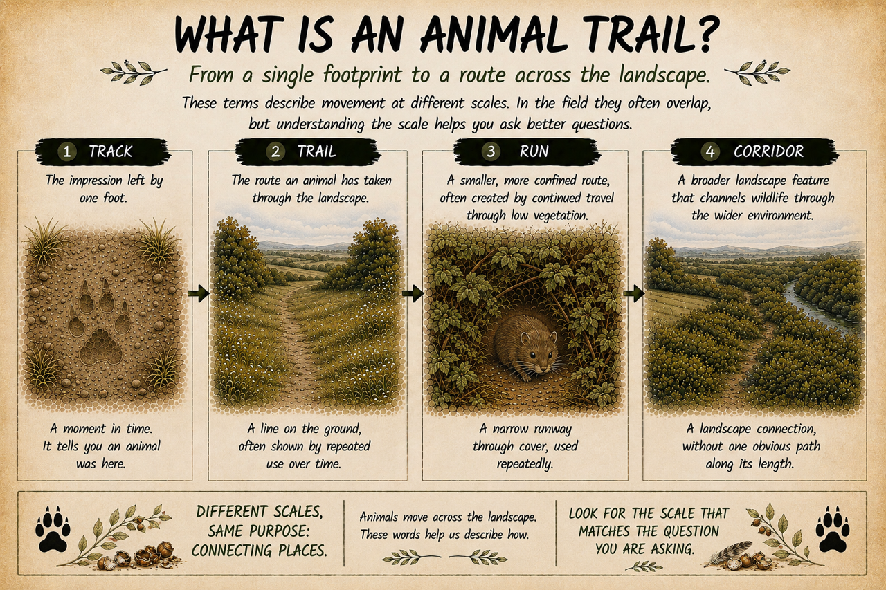
In the field these scales often merge into one another. What matters is recognising that we have moved beyond simply identifying a footprint. We are now looking at movement through the landscape.
That lets us ask rather better questions.
Where has the animal come from? Where might it be heading? Is this route being used repeatedly? Is one species using it or several? What other evidence should occur along it if our interpretation is right?
Those questions are usually more useful than trying to attach a species name to the first path we find.
Before You Follow the Trail, Read the Landscape
If you discover an obvious wildlife trail, your instinct may be to put your head down and follow it. I normally do almost the opposite.
Stand still for a moment and look around. Why should movement pass through here?
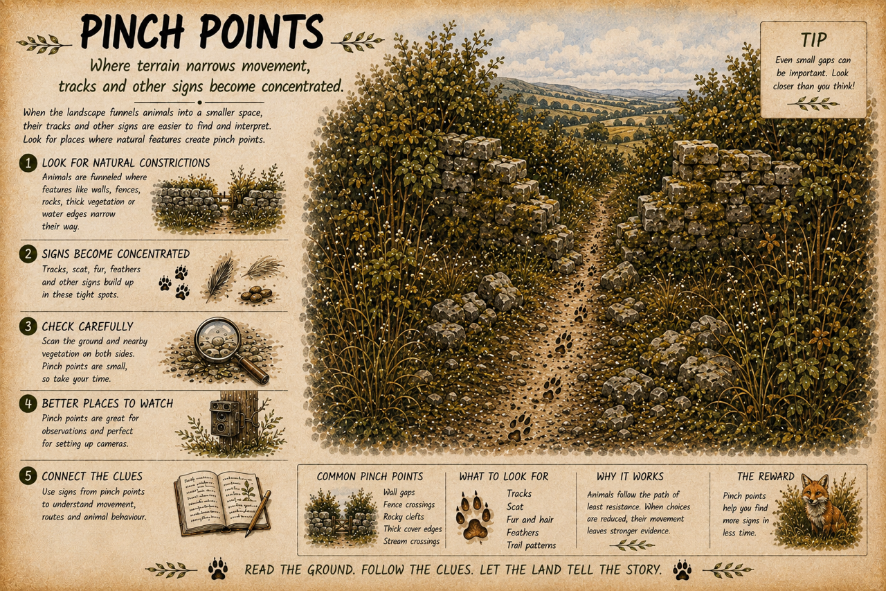
Perhaps there is a gap in the hedge. A steep bank becomes shallower at this particular point. One section of fence allows animals underneath it. Two areas of woodland almost meet, leaving a narrow strip of cover between them. A stream passes through a culvert beneath a road. A gateway provides the easiest route between two fields. These places interest me because the structure of the landscape itself can concentrate wildlife movement.
Think of a broad funnel narrowing towards its neck. Animals may be moving across a large area on one side, but if only a few practical routes lead through an obstacle, much of that movement can be squeezed through a surprisingly small space. These pinch points can be far more productive for finding tracks and signs than wandering across acres of apparently suitable habitat. A muddy gateway after rain is an obvious example. Most of the surrounding field might preserve nothing useful, while several animals have crossed the same two metres of soft ground at the gateway.
The same principle applies to gaps beneath fences, ditch crossings, culverts, fallen trees across streams, narrow strips of cover and places where several trails converge. The trail tells us that movement occurred. The wider landscape may begin to explain why movement is concentrated there.
What Does a Wildlife Trail Actually Look Like?
Some animal trails are impossible to miss. A heavily used badger path, for example, can become a broad route through vegetation, particularly close to a sett or where animals repeatedly cross a bank or boundary.
Many wildlife trails are much subtler.
Imagine we are walking along a woodland edge in late spring. From standing height the grass ahead looks fairly uniform. Lower your viewpoint and look along the vegetation rather than down onto it and a faint channel may appear. Stems lean away from the centre, seed heads are missing and occasional patches of bare soil show where feet repeatedly fall.
That change of viewpoint can be surprisingly revealing.
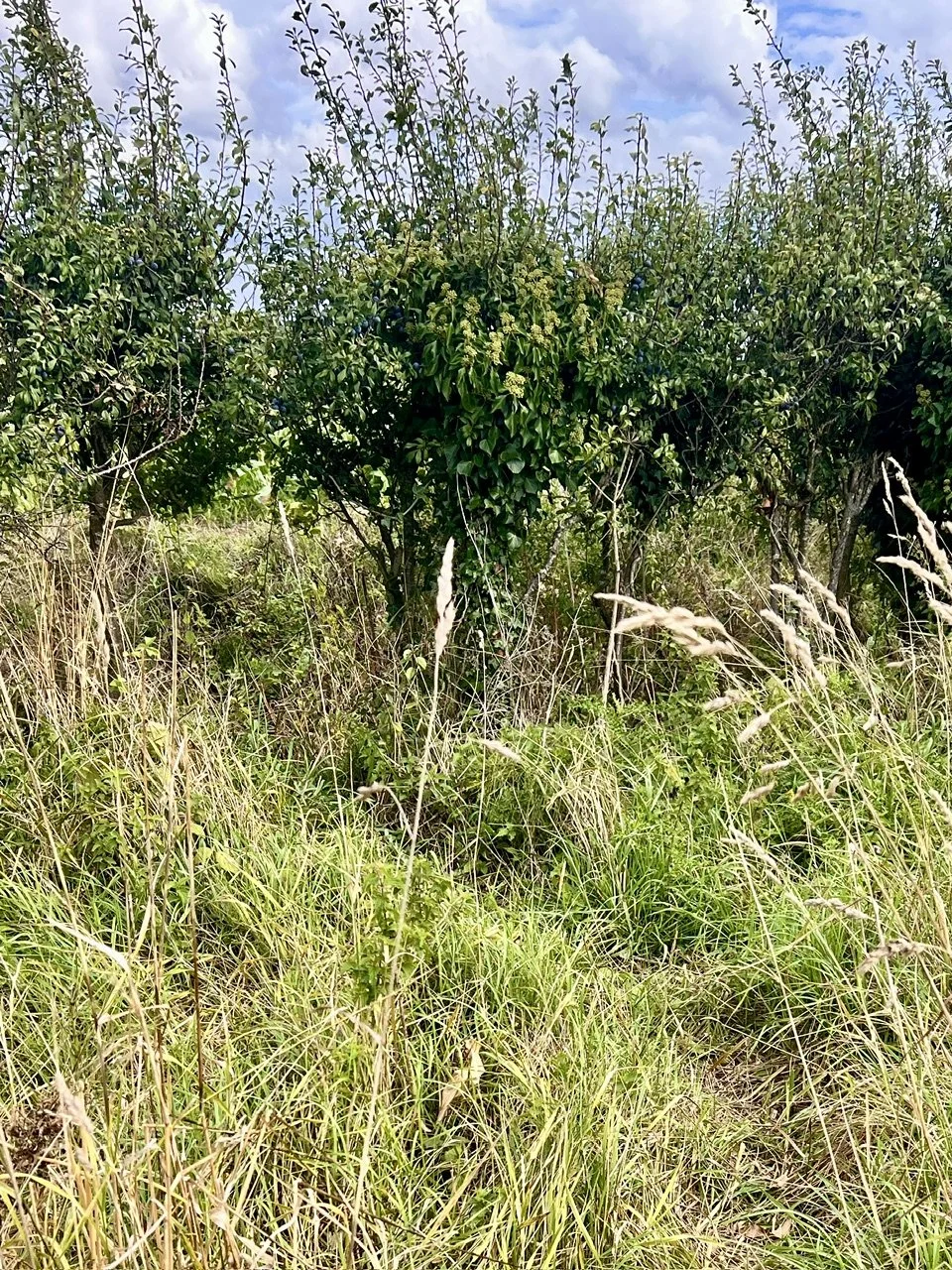
Look along the vegetation rather than straight down. A narrow line, leaning stems and a repeated opening into cover can make a subtle route easier to see.
Then start examining the route itself. Where it crosses bare earth, does the surface look more compacted than the ground beside it? Are there footprints where it reaches mud? Does it pass beneath a fence or low branch where hair might catch? Is a root crossing the path smoother than neighbouring roots? Does the vegetation form a tunnel?
None of those signs necessarily identifies the animal responsible.
Together, however, they can build a much stronger case that you are looking at a genuine wildlife pathway rather than a random opening in the vegetation.
Is It Really an Animal Path?
We are extremely good at recognising patterns, including patterns that aren’t actually meaningful. Not every line through vegetation has been created by wildlife.
Water can flatten grass. Fallen branches push plants aside. Livestock create paths. Dogs wander through woodland margins. People take shortcuts. Machinery can leave narrow routes that gradually soften and begin to look surprisingly natural. I therefore look for continuity and corroboration.
Does the path continue beneath a hedge and emerge on the other side? Does it lead towards another obvious landscape feature? Are there prints in the softer ground along the same line? Has hair collected at a narrow crossing?
This is one of the simplest ways to improve your tracking: stop asking one sign to do all the work……..a faint line through grass might be an animal trail, a continuous line associated with tracks, hair or repeated disturbance is a much stronger proposition.
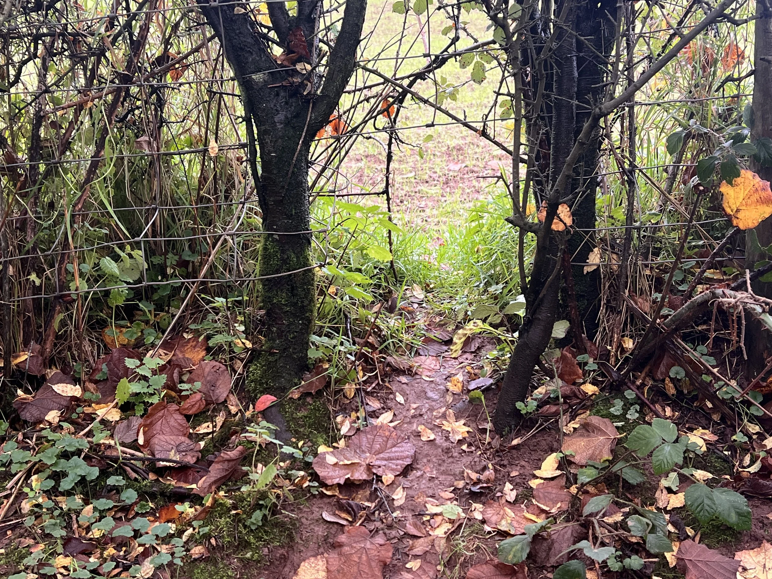
A gap through a hedge is suggestive, but the opening alone does not identify its user. Check the mud, vegetation and constriction for independent signs of repeated passage.
Which Animal Is Using the Trail?
This is where it is particularly easy to become overconfident.
Suppose we find a substantial path running through woodland and beneath a low fence. Badger might immediately come to mind. The dimensions look plausible, the habitat suits them and badgers occur locally. That makes badger a reasonable hypothesis. It does not yet make this a badger trail.
Now we find coarse black-and-white hairs caught beneath the fence and broad five-toed prints in mud further along. The evidence for badger use becomes considerably stronger. But even then I would be careful about saying the badger path (for more details of Badger tracks, field signs and how to identify a badger sett read this blog).
Foxes may use it as well. Deer may cross part of it. Rabbits or mustelids might exploit the same opening. Wild animals frequently share convenient routes. If one gap provides the easiest passage through a dense hedge, there is no reason only one species should discover it.
So rather than asking:
Which animal made this path?
I prefer:
Which animals are using this path?
That small change in wording prevents a surprising amount of poor field interpretation.
Shared Wildlife Trails Can Tell You More About the Landscape
I have seen this repeatedly at sites I monitor in the Wye Valley.
At one location, several routes converge around a gateway and adjoining cover. If I visited once, found fresh badger sign and then left, it would be very easy to think of the route primarily as a badger path. Longer observation gives a different picture. Badgers use it, but foxes use it too. Fallow deer regularly pass through the same area, while other mammals use routes immediately around the junction. The interesting discovery is therefore not simply that badgers travel there. It is that something about this particular piece of landscape repeatedly concentrates wildlife movement.
That leads to more useful questions: Does the gateway connect two areas of cover? Is it simply the easiest crossing? Are productive feeding areas nearby? Do animals approach along the same boundary before reaching it? Does the junction remain important throughout the year?
At that point the path has stopped being something we are trying to name and has become something we are trying to understand.
For a wildlife photographer or anyone using trail cameras, that distinction matters. A location repeatedly selected by several species may be far more useful than a spectacular-looking trail used by just one animal occasionally.
Is the Animal Trail Still Active?
A well-worn trail demonstrates use at some point. It doesn’t necessarily demonstrate use now. Paths can remain visible after activity has declined, particularly around old setts, former feeding sites or in vegetation that recovers slowly.
So I try not to ask whether a path simply looks active. I look for evidence of recent passage.
Fresh footprints are useful when the substrate allows them. Newly disturbed soil, recently bent vegetation, fresh droppings, feeding remains and new hair at established crossings can all contribute. But freshness requires caution.
Protected footprints can remain sharp much longer than expected. Exposed tracks may deteriorate quickly. Vegetation can recover rapidly or remain flattened for days depending on the plant and weather. Where possible, I prefer establishing sequence rather than pretending I can assign a precise time. If rain ended overnight and a sharp track clearly lies over the raindrop marks, we know the animal passed after the rain. That is defensible. Saying the animal passed three hours ago because the print “looks fresh” is much less secure.
Repeated visits solve some of this uncertainty. If you return to the same crossing and new tracks or disturbance appear, you are observing change rather than trying to estimate age from appearance alone.
Follow the Trail With Your Eyes Before Your Feet
Once we have decided that a path is worth investigating, I still wouldn’t immediately walk along it.
First look where it goes.
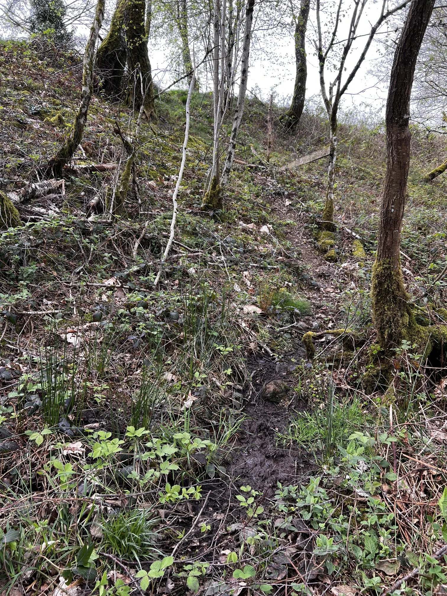
Before stepping onto a trail, trace its line through the scene. Here this muddy Otter trail continues up the slope and through denser cover. At the top of the hill is a reservoir where I found individual tracks of a mother and two cubs entering into the water.
Does it remain close to a hedge? Climb a bank? Cross a ditch? Head towards water? Join another trail? Disappear into dense cover? Sometimes the route becomes clearer by stepping sideways and viewing it across the landscape rather than standing directly on top of it. Now individual pieces of sign begin to connect.
Perhaps the path follows the bottom of a hedge, passes through a gap and enters pasture before disappearing into woodland fifty metres away.
Immediately we can predict places where better evidence might occur. The muddy hedge gap might preserve footprints. A fence crossing may collect hair. The pasture might contain feeding evidence. Where the route enters woodland it may divide again. Instead of randomly searching for tracks, we are allowing the animal trail to guide us towards places where diagnostic evidence is more likely to accumulate.
That is one of the most useful shifts you can make in the field.
Trails Lead You to Better Tracks and Signs
Most animals travel across far more ground than they leave readable footprints on.
A fox may cover hundreds of metres of dry woodland floor without giving us a useful track. Then it crosses twenty centimetres of wet mud and suddenly leaves a beautifully defined print (look here if you’re not sure what a fox paw print looks like and how to tell it apart from a dog track).
Once I recognise an animal trail, I start looking ahead for those natural recording surfaces. Mud is obvious, but also look at sand, silt, damp soil beneath bridges, puddle margins and freshly disturbed earth. Where the route crosses them, slow down.
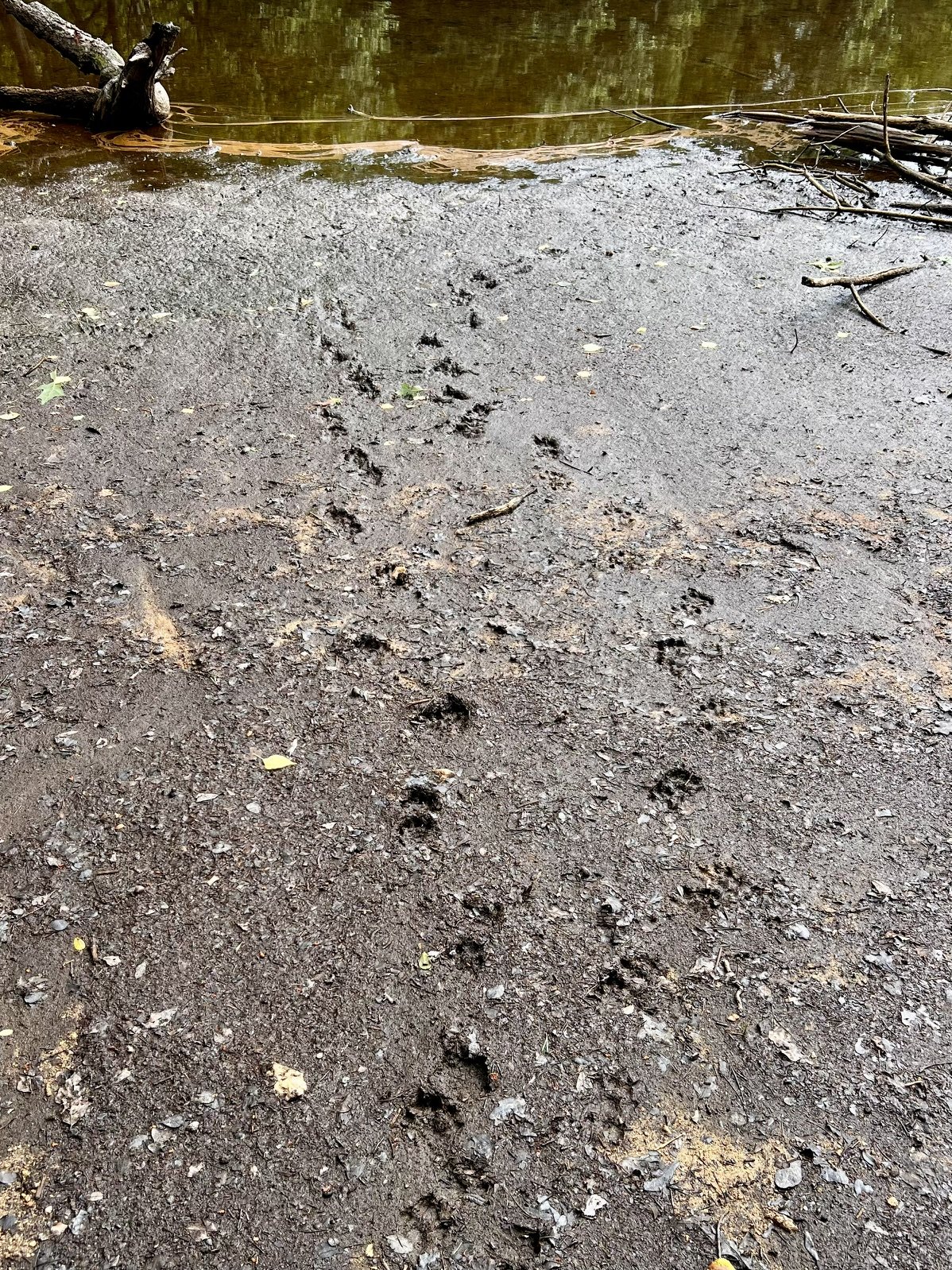
A muddy water margin acts as a natural recording surface. Rather than identifying every impression at once, first separate routes, directions and overlapping sequence.
The same principle works for hair.
An animal moving through open woodland may leave almost nothing behind. Make it pass beneath wire, between two branches or through a tight hedge gap and suddenly its body has to contact the surroundings. Those constrictions deserve close inspection.
The trail itself may remain ambiguous. The evidence it leads us towards may not.
Pay Attention Where Wildlife Trails Meet
Trail junctions are places where I naturally slow down.
Several routes arriving at one point create more opportunities for sign. Animals may approach from different directions, switch between boundaries or pause before continuing. Some species may also scent mark around repeatedly encountered features. Look particularly carefully at the best substrate around the junction rather than merely staring at the centre of the path. Check muddy margins, exposed soil and the edges of vegetation. Examine low branches, roots and fence wires. Look for scat, feeding remains and subtle disturbance.
From a trail-camera perspective, junctions can also be valuable because one position may sample movement from several directions, although camera placement should never obstruct a route or intrude into a sensitive resting or breeding site.
A modest-looking junction can sometimes reveal much more than a single heavily worn trail.
Where Does the Trail Lead?
This is where reading wildlife pathways becomes particularly interesting.
Trails often appear to connect resources: woodland with pasture, dense cover with open ground, water with surrounding habitat, or one productive feeding area with another.
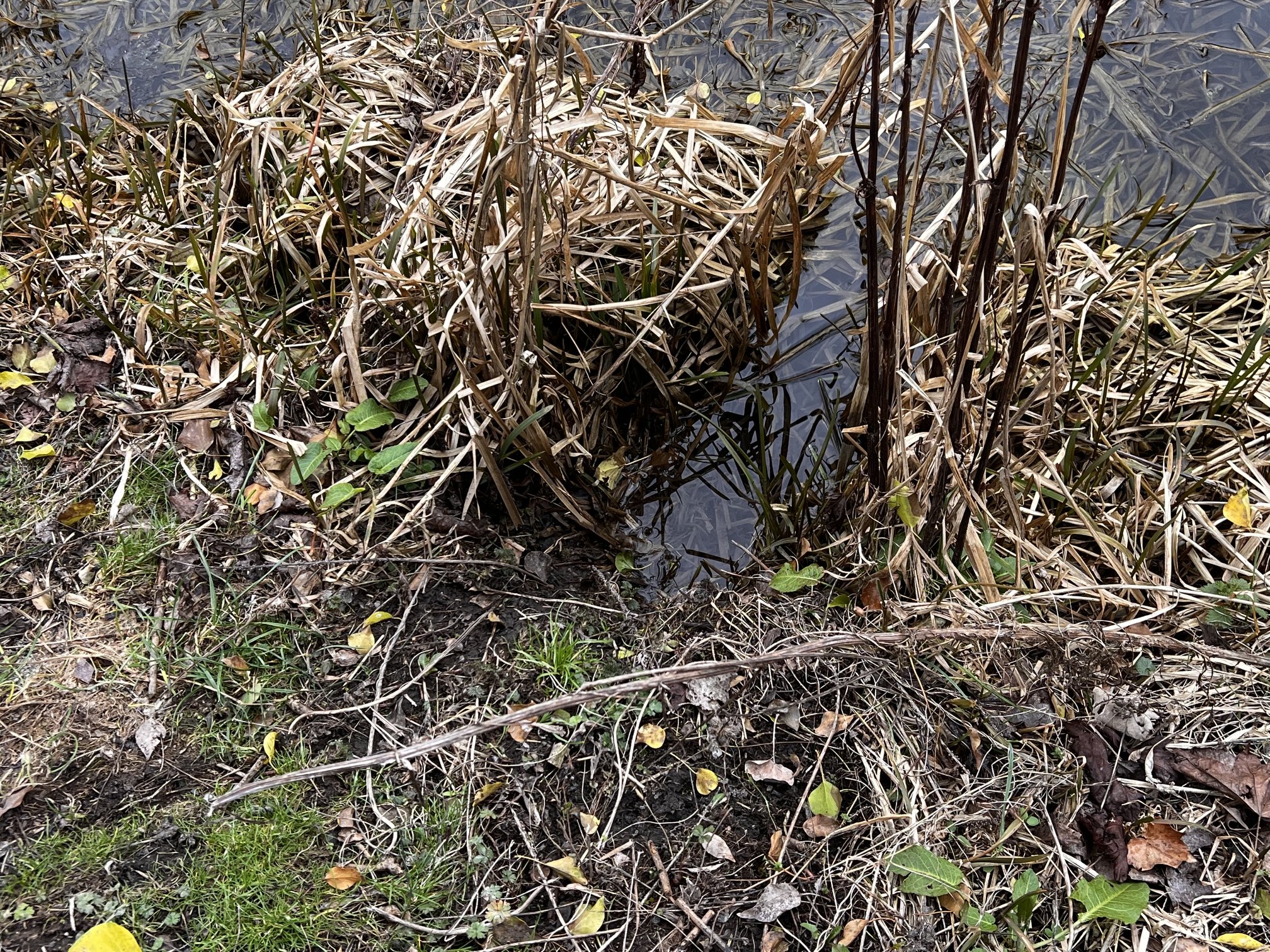
A narrow opening reaches the water through winter marginal vegetation. The route establishes direction; tracks, hair or other signs are still
needed before assigning a species or purpose.
But this is also where we need to keep observation and interpretation separate.
If we find a badger trail leading from a sett area across pasture, it is reasonable to investigate whether it connects the sett to feeding ground. Finding fresh feeding excavations further along the route would strengthen that idea. Without them, calling it a “feeding route” is still an interpretation.
The same applies to a fox path along a woodland edge. The animal may hunt while using it, but the path itself doesn’t demonstrate hunting. A deer trail leading into dense woodland might eventually reach resting cover, but we shouldn’t infer a bedding area merely because the trail disappears into trees.
The route gives us direction. Other evidence tells us what that direction may mean.
Can the Shape of the Route Reveal Behaviour?
Sometimes.
A relatively direct line through the landscape may suggest purposeful travel, while repeated changes of direction, short branches and disturbance around a productive patch may suggest foraging.
But I would never make that interpretation from geometry alone.
Terrain can force detours. An animal may investigate scent. Disturbance can alter movement. What looks like wandering to us may have an entirely different explanation.
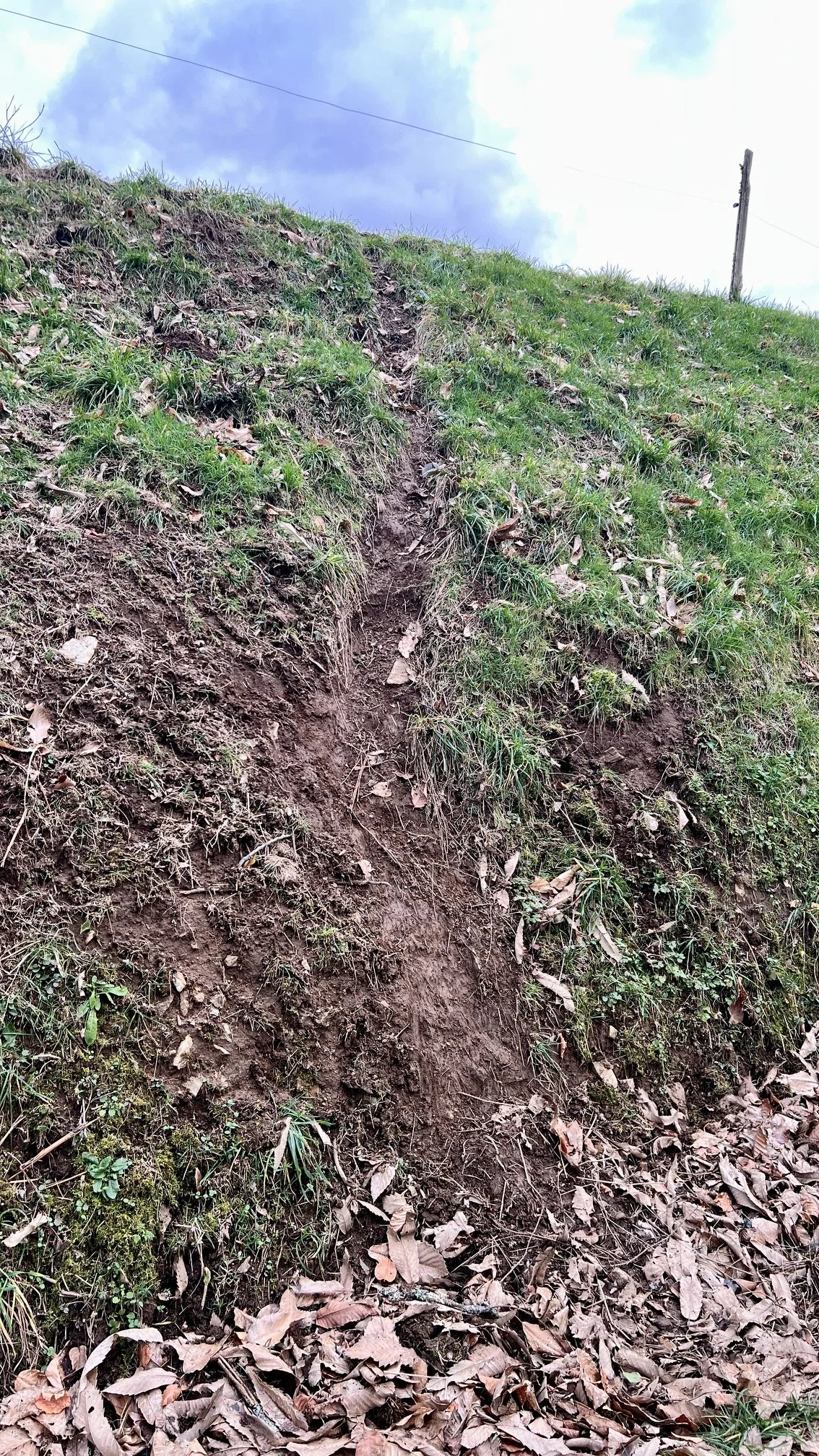
On a steep bank, the route may reflect the easiest workable line through the terrain rather than a particular behaviour. Geometry needs
contex.
The stronger interpretation comes when the shape of the movement agrees with other evidence.
Suppose a trail becomes less direct inside woodland. Several short side routes leave it. Soil has been disturbed and fresh feeding remains occur nearby. Now foraging becomes a more persuasive hypothesis. The trail pattern suggests it. The feeding evidence supports it. That is much stronger than asking either clue to prove the case by itself. If you want more information on how to identify feeding remains and who might of been feeding in a particular place read our dedicated blog.
Small Mammal Runs: The Same Method at a Different Scale
Everything changes when you get down to vole or mouse height, yet the basic approach remains the same.
For a small mammal, a grassy bank is a substantial landscape. Dense stems provide cover, fallen branches create obstacles and a few metres of exposed ground may represent considerable risk. Their pathways often appear as narrow tunnels or runways through grass and low vegetation rather than the obvious paths we associate with deer or badgers.
Get down close and look along the vegetation.
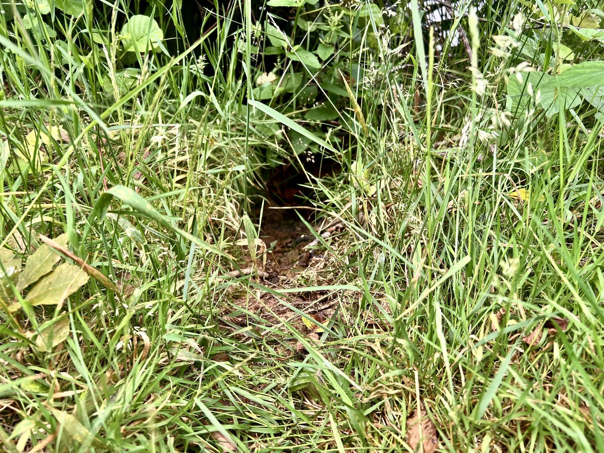
At ground level, an opening beneath the grass becomes visible. Its dimensions and associated signs are still needed before identifying the
animal using it.
You may find openings beneath the grass, clipped stems, droppings or repeated channels following the base of a bank. The scale has changed, but the evidential discipline hasn’t. A narrow run tells us something is repeatedly passing through it. Its dimensions and associated signs may narrow the possibilities. They do not automatically identify the species.
Know When to Stop Following
There is another reason not to follow every animal trail to its end. Sometimes the destination is exactly where the animal most needs to be left alone.
A trail disappearing into thick cover may approach a badger sett, otter resting site, fox earth, nest, breeding location or daytime refuge.
Once the evidence suggests that we may be approaching somewhere sensitive, reaching the end of the trail stops being the objective. For a wildlife photographer, understanding the outer part of the route may be all that is necessary. You can then choose an appropriate observation point well away from the resting site and allow the animal to move naturally. Good tracking isn’t about pursuing wildlife until you find it. It is about gathering enough evidence to understand what an animal is doing without making your own presence part of the behaviour you are trying to observe.
A Simple Way to Investigate an Animal Trail
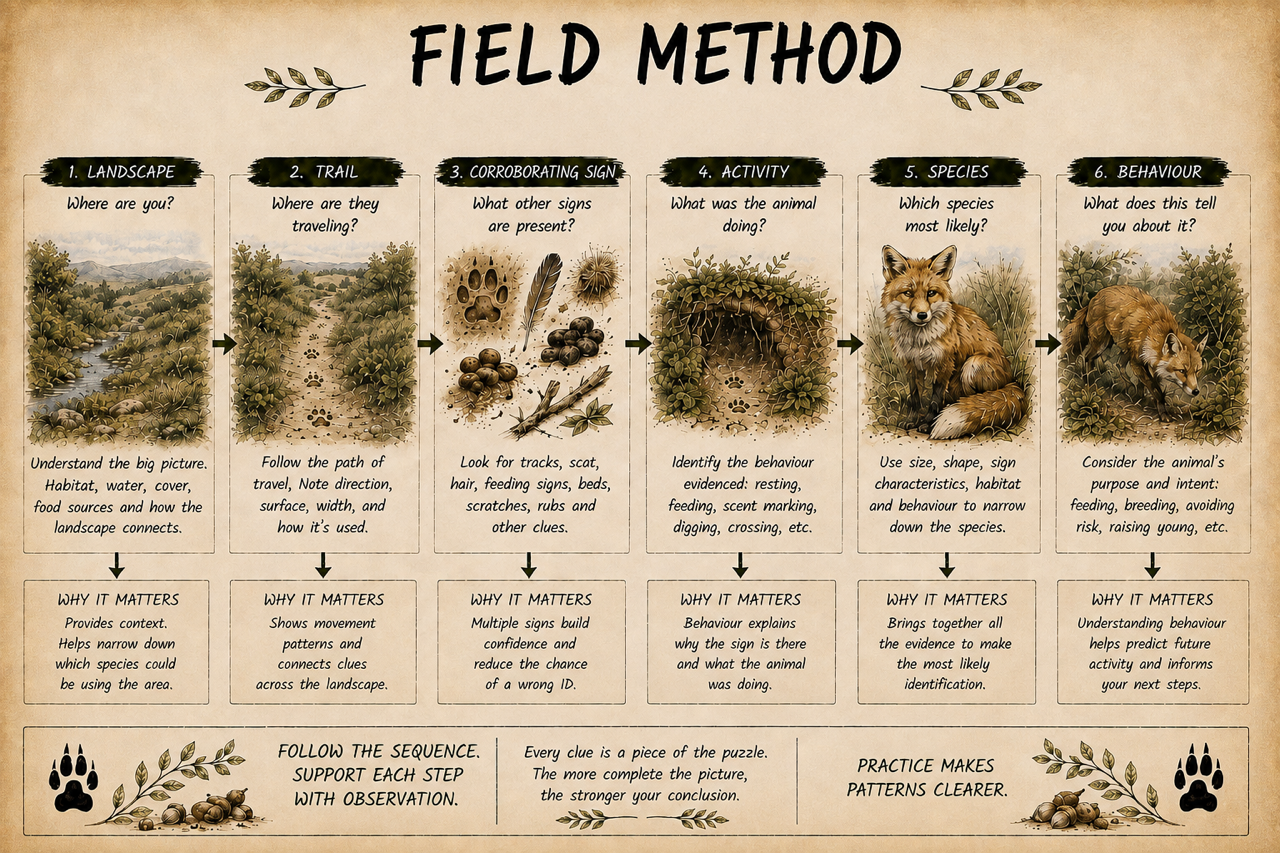
The next time you find a possible wildlife path, try spending five minutes investigating it before you decide what it is.
Start a few metres back and look at the landscape. Ask what the route appears to connect and whether some feature is funnelling movement through that point.
Then describe what you can actually see. Is there a continuous path, flattened vegetation, bare soil or a gap beneath a fence?
Now look for independent evidence. Check suitable patches of mud for footprints. Examine constrictions for hair. Search nearby for droppings, feeding remains or digging.
Only then start considering which animals might be using it.
A field note might eventually read:
There is a well-used mammal trail beneath this hedge. Five-toed footprints occur in mud along the same line and coarse black-and-white hairs are caught on the lowest strand of wire. Badger appears to be a regular user, although the trail may also be shared by other species.
That sounds less decisive than arriving and immediately announcing “badger path”. It is also much better tracking.
From Animal Trail to Wildlife Map
Once you deliberately start looking for animal trails, something changes in the way you see familiar ground. One path appears beneath a hedge. Then you notice another joining it. A muddy crossing provides footprints. Further along, the route divides at the woodland edge. One branch heads towards dense cover, another towards pasture. There is a fence crossing at one end and feeding sign near the other.
None of those clues necessarily tells the entire story, but together they begin to form a map……and that, for me, is the real value of reading animal trails and wildlife pathways.
Tracks tell us that an animal was present. Trails allow us to think about movement: how different parts of the landscape connect, where animals repeatedly pass and where we should look next for stronger evidence. The aim isn’t to turn every faint line through grass into a confident story about what an animal was thinking. Quite the opposite.
The trail is the beginning of the investigation.
So next time you notice a narrow line disappearing beneath a hedge, don’t immediately ask:
“What animal made that?”
Stand back first and ask:
“Why does movement pass through here, where might this route lead, and what other evidence should I find if my interpretation is right?”
Those questions will usually teach you much more.
Frequently Asked Questions
When is the best time of year to look for animal trails in the UK?
There is no single best season because different conditions reveal different evidence. Summer vegetation can make well-used runs and pathways particularly conspicuous, while autumn and winter reduce vegetation and make it easier to see routes through woodland. Wet weather is often especially useful because muddy gateways, banks and crossings begin recording footprints. Snow, when we get it, can briefly reveal movement patterns that remain almost invisible for the rest of the year.
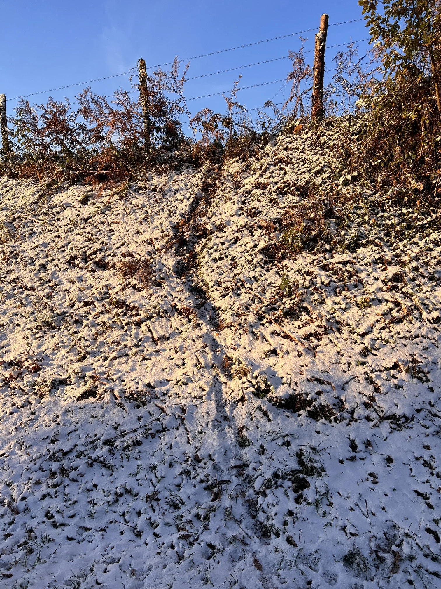
Even a light fall of snow can reveal repeated crossings on a bank. Use it to map movement first, then inspect individual lines for diagnostic tracks.
Do wildlife trails change with the seasons?
Yes. Some routes remain important throughout the year, but others change as food, cover, water levels and vegetation change. A path leading to fallen fruit may become heavily used for a few weeks and then virtually disappear from use. Seasonal changes are one reason I would be cautious about assuming that a clearly worn trail is currently important.
How can you tell an animal trail from a human footpath?
Scale and destination help, but there isn’t a single diagnostic feature. Wildlife trails often pass beneath obstacles, enter dense vegetation, follow field boundaries or take routes that would be inconvenient for people. Human paths generally accommodate an upright person and often have a broader, more uniformly worn surface. The real giveaway is often associated sign: footprints, hair, droppings and feeding evidence can establish wildlife use even when the origin of the path itself is uncertain.
What is the difference between an animal trail and a wildlife corridor?
Think of them at different scales. An animal trail is usually a recognisable route on the ground created or maintained by repeated movement. A wildlife corridor is a broader landscape feature that allows animals to move between areas of habitat. A hedgerow, river valley or strip of woodland might function as a corridor while containing several individual trails and crossings.
Can animal trails help me decide where to place a trail camera?
They can, but the most obvious trail is not automatically the best camera site. I would usually look for a pinch point, crossing or junction where movement is concentrated and where the camera can record animals without obstructing their route. Before leaving a camera, also consider whether the trail approaches a sensitive resting or breeding site. The objective is to observe natural movement, not change it.